Geography of greece
Greece is located in Southern Europe, on the southern end of the Balkan Peninsula. The north of the country is surrounded by Bulgaria and the rest of the country is surrounded by oceans.

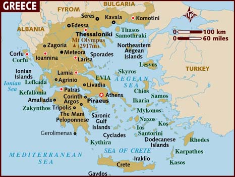
This is a map of Greece. Which shows how 20% of Greece is made up of islands.
These are the names of the oceans surrounding Greece, to the west the Ionia Sea, to the south the Mediterranean Sea and to the east the Aegean Sea. There are a large number of islands, including Crete, Rhodes, Corfu, the Dodecanese and the Cyclades.
This video sums up the geography of Greece in a bit more depth.
80% of Greece is mountainous, it is in fact one of the most mountainous countries in Europe, and the other 20% of Greece is made up of tropical islands. Greece is 131,940 km2, 58 and half times smaller than Australia. The Mediterranean region has mild, wet winters and hot, dry summers. Western Greece is mainly Alpine climate which means average weather above the tree line.
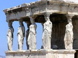
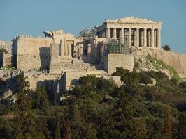
The Acropolis was built by Pericles in the 5th century BC. This is a main landmark of Greece which is now full of cafes and small shops. Many women traveled to the sacred place to pray for their husbands to come home because they were sick of them fighting against Sparta.
Athens is the capitol of Greece, which is where the Athenians lived. They had very different roles in their lives to the Spartans who lived in the city of Sparta.